Leveraging Satellite Imagery for Precise Ground Condition Assessments in Football, Tennis, and Racing Venues
Satellite imagery delivers high-resolution data on surface moisture, grass density, and soil compaction that ground crews and analysts use to evaluate playing surfaces before and during events, and this information feeds directly into live market adjustments across football, tennis, and horse racing. Operators collect multispectral images from platforms such as those operated by the European Space Agency, which track vegetation health indices and water content at regular intervals, allowing teams to correlate these readings with historical performance metrics on similar surfaces.
Data Acquisition and Processing Methods
Researchers process raw satellite feeds through algorithms that convert reflectance values into quantifiable ground parameters, including volumetric water content and surface temperature gradients, while ground-based sensors provide calibration points that refine the models. In practice, daily revisits from constellations deliver updates every few hours during peak competition periods, and analysts overlay these layers onto venue maps to identify zones where traction or bounce characteristics deviate from seasonal norms. Observers note that combining optical and radar bands improves accuracy under cloud cover, which proves essential for outdoor venues that host evening fixtures.
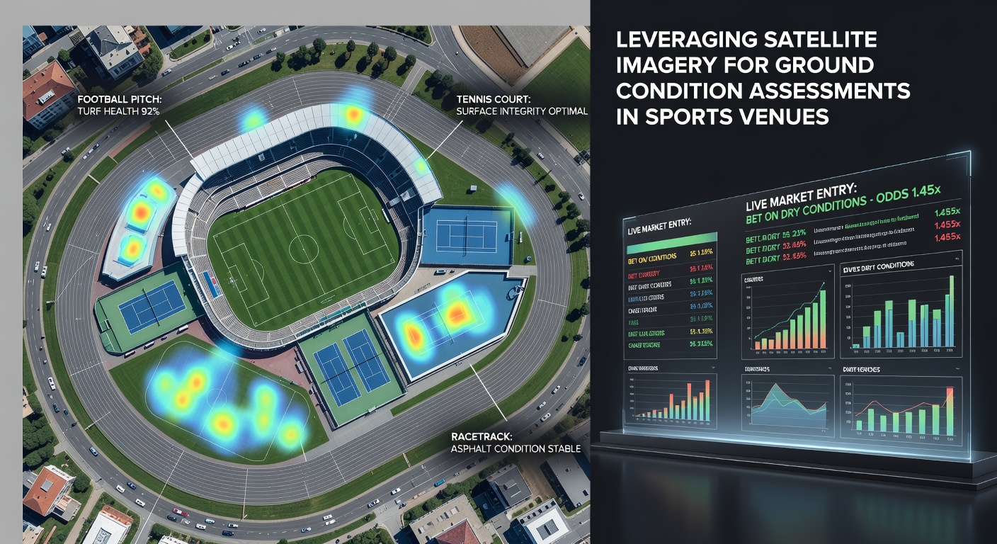
Application Across Football Pitches
Football analysts examine pitch hardness and grass cover percentages derived from satellite indices to anticipate how ball roll and player movement might shift during matches, and these assessments influence live odds on total goals or corner counts when surfaces show signs of softening after rainfall. Data sets compiled during European league campaigns demonstrate that pitches with elevated moisture readings correlate with reduced sprint distances, prompting adjustments in expected goal models that betting platforms incorporate in real time. Venues in regions with variable weather patterns benefit most because satellite passes capture changes between morning training and evening kickoff.
Tennis Court Surface Monitoring
Tennis surfaces, whether clay or grass, reveal subtle variations in color and texture through normalized difference vegetation index values, which help officials and statisticians predict ball speed and bounce height before sets begin. Satellite observations during major tournaments in June 2026 captured gradual drying trends on outer courts that aligned with recorded rally lengths, supplying quantitative inputs for live game-line markets. When combined with temperature data, these readings allow precise timing of irrigation schedules that maintain consistent play characteristics throughout multi-day events.

Racetrack Condition Evaluation
Racetrack operators rely on satellite-derived soil moisture maps to forecast going conditions hours before the first race, and these forecasts feed into each-way and place market calculations when track bias emerges. Studies from institutions such as those supported by NASA Earth Science Division show that radar backscatter measurements detect subsurface water accumulation that affects stride lengths on turf courses, enabling trainers and punters to adjust expectations for pace and stamina demands. In June 2026 meetings, repeated satellite passes documented rapid drainage after overnight showers, which narrowed the window for market entries on ground-dependent selections.
Integration with Live Market Entries
Platforms integrate satellite outputs into automated dashboards that trigger odds revisions when ground parameters cross predefined thresholds, and this process operates alongside traditional scouting reports to create layered risk assessments. For example, a sudden spike in surface temperature on a clay court can signal faster conditions that shift implied probabilities for baseline versus net play styles. Data from multiple venues indicates that such integrations reduce latency between observed changes and market updates, supporting entries that reflect current surface states rather than pre-event assumptions. Analysts cross-reference these feeds with timing systems at racetracks and player tracking data on pitches to validate the satellite readings against on-site measurements.
Challenges and Technical Considerations
Resolution limits in older satellite generations sometimes obscure fine-scale variations on smaller tennis courts, prompting operators to fuse imagery with drone surveys for higher granularity during critical periods. Cloud interference remains a factor in temperate climates, although synthetic aperture radar mitigates this issue by penetrating atmospheric layers. Regulatory frameworks in different jurisdictions, including guidelines from bodies such as the Australian Communications and Media Authority, address data privacy when venue operators share imagery with third-party analytics providers. Accuracy improves when calibration occurs at multiple ground truth sites, yet seasonal vegetation cycles require ongoing model retraining to maintain reliability across competition calendars.
Future Developments in Satellite Applications
Upcoming constellations promise sub-meter resolution and more frequent revisits that will further tighten the link between ground conditions and live market dynamics. Partnerships between space agencies and sports technology firms already test machine learning pipelines that classify surface types automatically, reducing manual interpretation time during busy fixture periods. Observers expect these advances to expand coverage to secondary venues that currently lack dedicated monitoring equipment, broadening the dataset available for cross-sport comparisons in accumulator constructions.
Conclusion
Satellite imagery supplies objective, repeatable measurements of ground conditions that directly inform timing and selection criteria in live football, tennis, and racing markets. Continued refinement of processing techniques and sensor networks supports increasingly granular assessments that align surface data with performance outcomes across these disciplines.